Lakes in Carinthia – including popular bodies of water such as Lake Wörthersee, Lake Ossiacher See and Lake Weißensee – are under more pressure than ever before: from recreational use, shoreline construction and climate change. Not a single lake currently meets the ‘very good’ ecological status required by the EU Water Framework Directive. Particularly alarming is the decline in aquatic plants (macrophytes), which are an important indicator of a healthy ecosystem.
One possible culprit is the increase in boat traffic. The waves generated by boats alter the currents in shallow shore zones, dissolve sediments and damage plants – but so far there is a lack of clear data to take targeted protective measures.
This is where the WAMOS (Wave Monitoring System) research project comes in. The aim is to find out how much boat traffic affects macrophytes – and what countermeasures (such as wave protection systems) are appropriate.
To this end, an interdisciplinary monitoring system is being developed that links waves, sediment and plant life. At its core are intelligent measuring buoys that record wave heights in sensitive shore zones in real time. Using precision data (Galileo satellites) and acceleration sensors, they calculate the energy of the incoming waves.
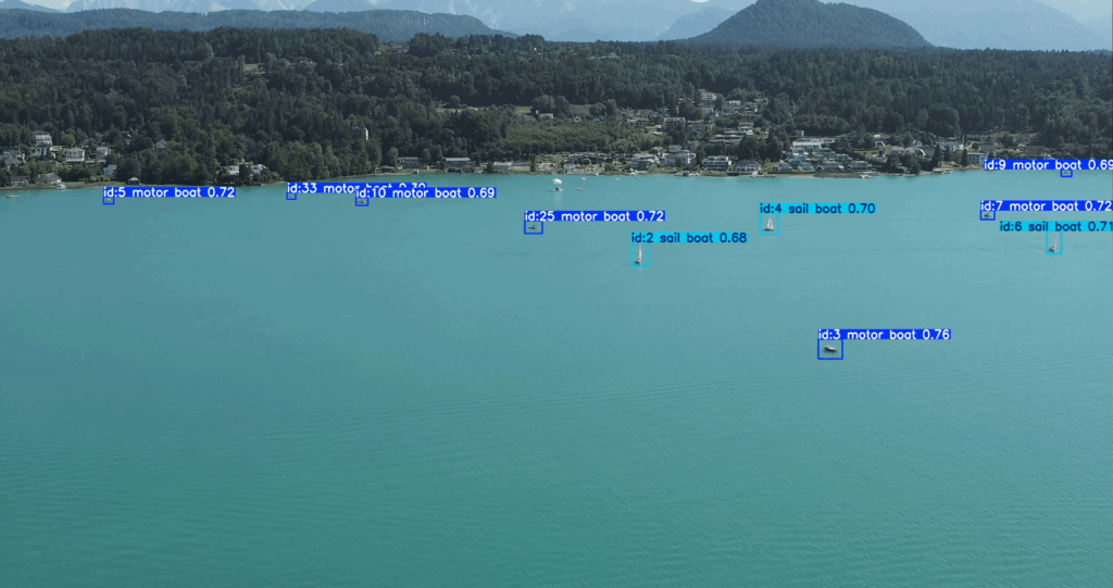
To record boat traffic, the SIENA research group uses drones that systematically record videos of the lake surface. These recordings are automatically analysed using artificial intelligence: boats are detected, classified by type and tracked across multiple images to reconstruct their movement paths – pixel-based trajectories. In the next step, these trajectories are georeferenced, i.e. converted from the camera image into real geographical coordinates. This not only allows the speeds of the boats to be determined accurately, but also their distance from the shore – a crucial factor in assessing the impact of wave action on sensitive habitats.
At the same time, the shore zones are examined for biodiversity: How species-rich are the macrophytes? Where is the ecological condition worst, where is it best? All data is collated – measured at Lake Wörthersee, but transferable to other lakes. This creates a scientific basis for planning targeted protective measures.
Conclusion: WAMOS reveals what has long been suspected – and makes it possible not only to protect lakes, but also to actively restore them to a healthier state.