Drone Zone Austria represents a scientific exploratory approach to develop a Web Portal in order to provide relevant high resolution spatial information for supporting legally compliant drone mission planning in Austria.
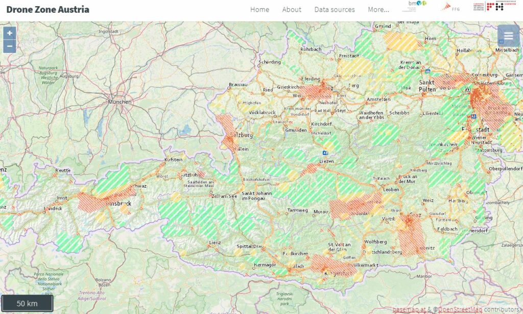
Based on current legislation in Austria the important constraints to consider for safe drone mission planning are (I) the area of operation (i.e. settlement density), (II) key aeronautical information (e.g. aerodromes, control zones, flight restriction zones, etc.) and (III) presence of environmental protected areas (e.g. National parks, Natura 2000 areas, etc.). Drone Zone Austria is a project that for the first time provides a nationwide holistic integration and a compiled map-based high resolution view of the local distribution of these mission planning critical spatial data sources to support safe drone mission planning and operation.
Data Sources and Data Quality
Data sources like Google Maps, Google Earth or Bing Maps are most commonly used as a source of information for Remotely Piloted Aircraft Systems (RPAS) mission planning, but they have no legal reliability and do not guarantee actuality. At the same time, RPAS mission planning is a spatial task that needs high quality, accurate and up-to-date situational awareness information about the area of interest for safe planning and operation. Therefore the key foundation of the Drone Zone Austria portal is a geospatial Drone Zone Model derived from available up-to-date high quality trusted national geodata sources, which are provided by the Austrian public administration and the Austrian Aviation Control as a result of the Open Government Data Initiative and the European INSPIRE Geodata Infrastructure directive.
To find out more about the project click here.

