Innovative methods for high-resolution digital surveying and automated classification of lakeshore areas in Carinthia
For the implementation of the European Water Framework Directive, monitoring and the classification of lakeshore areas by use are key methods for assessing lake quality.
Currently, this assessment of the potential for restoration is being conducted by experts based on video footage taken from a boat. Due to the low angle of the video footage taken from the boat, only the areas immediately adjacent to the water can be visually captured; other areas of the shoreline further from the water’s edge are often not visible or are obscured by shoreline vegetation.
The subsequent manual analysis of the videos by experts is very time-consuming, and the classification results depend heavily on the experience of the individuals involved.
As part of the pilot project “Innovative Methods for High-Resolution Digital Surveying and Automated Classification of Lakeshore Areas in Carinthia,” new methods for mapping the lakeshore were applied using Lake Ossiach in Carinthia as a case study and critically evaluated for their practical applicability.
This pilot project was commissioned by the Carinthian Lakes Commission using revenue from the motorboat tax and was successfully implemented in close collaboration with the Carinthian Institute for Lake Research.
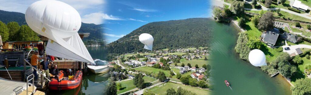
Data collection was carried out during two Helikite flights on November 18, 2024, and September 8, 2025.
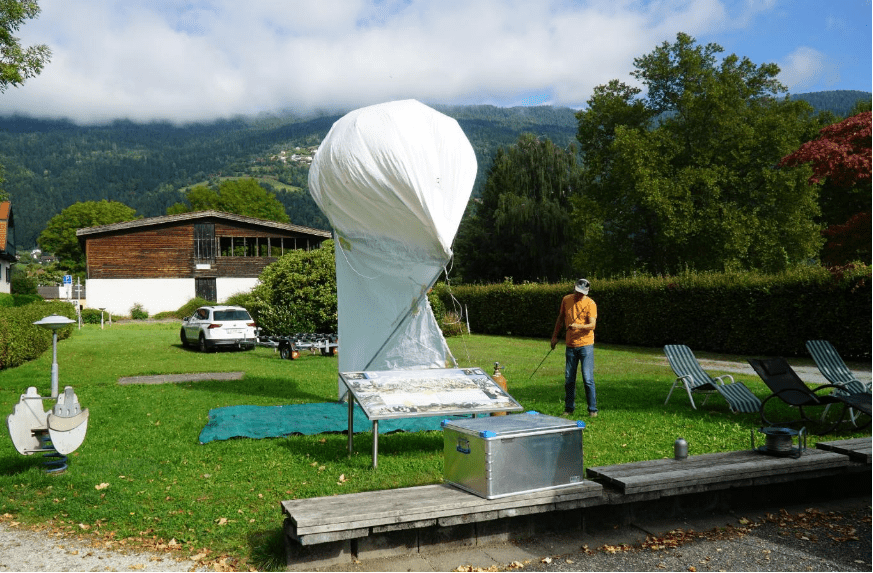
Assembling the Helikite and filling it with helium gas
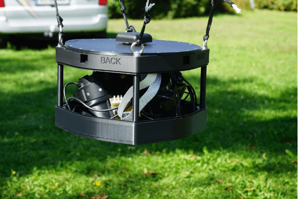
Pentacam - 5 x SONY ILCE-QX1 system cameras, each with 20 MP and GNSS, in a custom housing
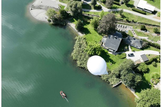
Helikite complete system during data collection
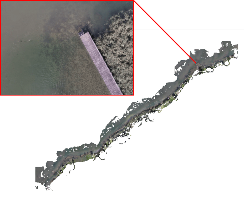
For each mission, approximately 3,000 individual images were captured from a flight altitude of about 60 m. The resulting ground resolution was 8 mm/pixel, covering an area of 0.25 km². The image data from both missions were processed using photogrammetric methods to create georeferenced orthomosaics. Based on these orthomosaics, an automated object classification was performed, distinguishing different object classes in the riparian zone from one another based on spectral and geometric characteristics.
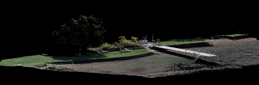
The photogrammetric processing of the image data was carried out in several sequential steps. First, a sparse point cloud was generated, which describes the relative camera position and orientation as well as an initial three-dimensional structure of the study area.
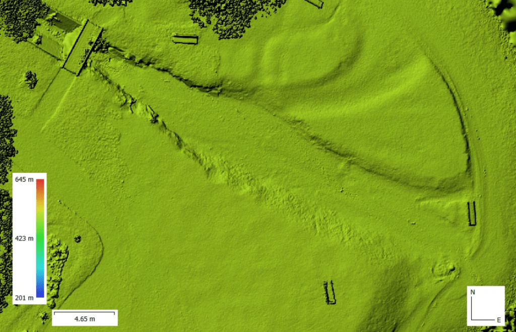
Based on this, a dense point cloud was generated, providing a high-resolution, comprehensive three-dimensional representation of the terrain and object surfaces. A Digital Surface Model (DSM) was then interpolated from the dense point cloud, depicting the elevation distribution of all above-ground objects, including vegetation and structures.
The final product was a georeferenced orthomosaic generated from the rectified individual images and the DSM. This orthomosaic provides a true-to-scale, distortion-free, high-resolution representation of the shoreline area and served as the basis for the subsequent automated object classification.
Orthomosaic from the mission on September 8, 2025, with a ground resolution of approximately 8 mm
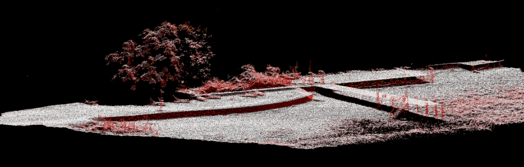
3D point cloud in RGB and the calculated z-normals for deriving man-made structures
Detailed view of the digital surface model (DSM) of the shoreline area